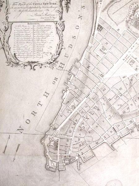
A colleague recently was asking around trying to figure out how much of what we consider Lower Manhattan (below Chambers Street) is built on landfill. Out best guess was somewhere around 300 acres or so (including the 92 acres of Battery Park City). This map, which I think is from the very early 19th century, really drives the point home.
What I find most interesting about the map, however, are the wards. It may be hard to make them out, but this map divides Downtown into a series of strips that run south to north. What’s interesting about it to me is that they recognize the Hudson as the west side of the city and the East River as the east side. This makes a lot of sense to us now, but when New Amsterdam was founded, the Hudson was thought of as the north side of town and the East River as the south. I never knew when this shift in orientation occurred, but the way the wards are assigned here makes me think it was right around the time this map was drawn.
Also, I think we’re done naming new neighborhoods in this city, but I’d get behind bringing “DockWard” back for the southeast corner of Downtown. I’d even support the inevitable DoWa.
Got a favorite picture of Downtown? Send it to [email protected]!


